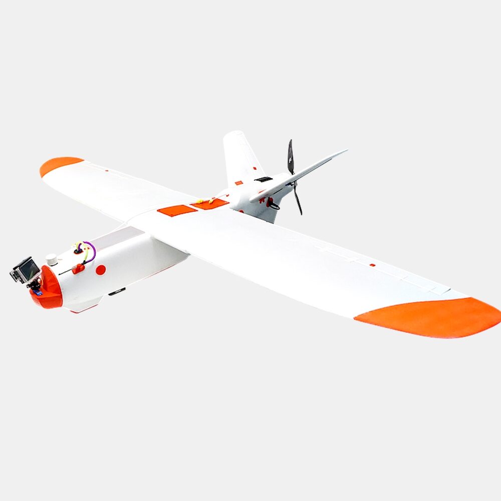
Description
The Aeromapper Talon LITE is a very affordable & customizable UAV system ideal for mapping & surveying, inspection, monitoring, surveillance, PPK mapping, precision agriculture. Features an impressive flight endurance thanks to its improved LiIon power system, super-easy to use, dependable and also equipped with long range data links for operations Beyond Visual Line of Sight. This drone is ideal for very large mapping operations or extensive areas. The Aeromapper Talon LITE offers the absolute lowest cost per mapped acre, guaranteed.
- Available with Emlid Reach M2 PPK UAV Mapping kit for centimeter accuracy with no GCPs.
- 2hr and 50 mins flight endurance with 36 Mp RGB camera
- 24 Mp RGB camera also available
- Multiespectral, thermal and video downlink payloads also available.
- Long range data link: up to 30km link distance away from GCS. Ideal for BVLOS operations.
- 5 minutes setup time in the field.
- Hand launch; automatic belly landing.
- Fully autonomous.
- Maps up to 10 Kms2 (2,479 acres) per flight at 400ft agl achieving 2.4 cm/pixel.
- Available with Emlid Reach M2 PPK UAV Mapping kit for centimeter accuracy with no GCPs.
- No training necessary.
System includes:
- Aeromapper Talon LITE
- LiIon battery and battery charger.
- 30 Km Link system for BVLOS operations.
- User’s Manuals & Documentation.
- Mission Planner Software.
- Unlimited support.
- ADS-B live air traffic data system.
* Payload available separately.
* This drone does not have parachute system.
* Carrying available separately
Specifications:
- Construction: EPO foam (durable, easy to repair, carbon fiber reinforced).
- Wingspan: 2 m.
- Weight: 3,100 grs.
- Endurance: 2 – 3 Hours in standard configuration (depending on payload selection).
- Launch: Very easy to hand-launch.
- Landing: Automatic belly landing.
- Maximum payload: 480 grs.
- Communications link range: +30kms. Tested in real BVLOS flight operations (Beyond Visual Line of Sight).
- Max. Altitude: About 4500 masl.
- Cruise speed: 48 Km/h.
- Flight modes: Manual, Stabilize, Return to Home, Fly be Wire, Auto.
- Wind Tolerance: up to 35 km/h. for flight and autonomous belly landing.
- Maximum speed: +90 Km/h.
- Failsafe: Automatically returns to home & loiter upon loss of RC link. Other failsafe routines available.
- Telemetry: Battery status, alt, ground speed, compass, attitude, distance travelled, time on air (speech enabled), and more than +200 parameters more.
- Moving map display / telemetry: Drone position and heading, commands on map, fly to point on map, altitude changes, remote spot camera trigger, mission route, and more.
- Weather: -20oC to +40oC