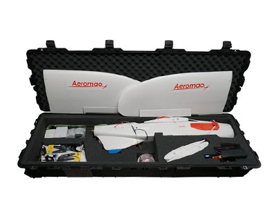
For over a decade, the Aeromapper Talon has enjoyed tremendous success and has been celebrated for its outstanding reliability, user-friendly design, and cost-effectiveness. This turnkey sUAS system is the ultimate choice for ultra-precise data collection, scouting, monitoring, mapping, and surveying. Its spacious design allows for the integration of a wide variety of payloads, making it versatile for numerous applications.
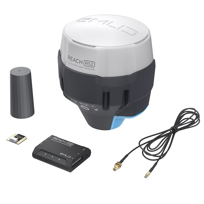
The new Sony 61MP RGB mapping camera is now available for even greater performance. Paired with the Emlid Reach M2 multi-band PPK UAV Mapping Kit, this advanced system delivers ultra-accurate, high-resolution results. With the capability to map more than 480 hectares per flight at 1.5cm/pixel resolution, it ensures centimeter-level accuracy for your most demanding projects.
In addition, our new range of versatile day/night zoom payloads is designed for long-range surveillance and scouting. These payloads deliver crystal-clear real-time imagery over extended distances, ensuring superior operational efficiency and situational awareness.
Multirotor drones, while effective for short-range or small-scale operations, often fall short when tasked with patrolling vast areas or monitoring distant points of interest due to their limited flight time and slower cruise speeds. If you’re seeking a reliable, cost-effective fixed-wing solution for long-range missions—whether scouting expansive territories or maintaining aerial surveillance over areas beyond 20 kilometers—the Aeromapper Talon is the ideal choice.
With over 2 hours of flight endurance, a cruise speed of 58 km/h, and exceptional wind resistance, the Aeromapper Talon enables users to cover 10 times the inspection area compared to small multirotor drones. Its pure-breed fixed-wing design offers unmatched performance and simplicity, standing out against more complex VTOL designs that rely on multiple motors and intricate setups. The Talon’s compact, clutter-free design makes preparation and operation effortless, allowing it to be flight-ready in just minutes. Batteries are hot-swappable so that missions can run back-to-back, significantly enhancing user productivity and making it ideal to map very large areas.
The Aeromapper Talon is also engineered for deployment in tight spaces, thanks to its ultra-easy hand-launching technique and an optional parachute landing system. Its field-proven, long-range communications link range allows it to operate up to 30-40 kilometers from the launch point, making it an ideal platform for BVLOS (Beyond Visual Line of Sight) missions.
The Aeromapper Talon is a Transport Canada compliant drone and is also offered as an amphibious version for maritime operations.